Hiking Los Alamos 101: Geology
Admission
- $8.00 - Drop-In One Session
- $20.00 - All 4 Sessions
Location
[No City], NM
United States of America
Description
This program is now full. Please call PEEC at 662-0460 to be put on the waiting list.
Are you interested in getting out on the trails in Los Alamos, but hesitant to begin exploring on your own? Want to know more about Los Alamos trails and what lives and grows on them, about the rocks that make our canyons and mesas so beautiful, and about the history of our area? Join Hiking Los Alamos 101 to dip your toes into all the fascinating hiking, biology, geology and history of our local trail system. Local Subject Matter Experts will take you on a hike of 2 miles or less and share with you their knowledge of the area.
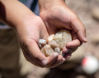
Popular presenter and local geologist Patrick Rowe will lead the second session that will focus on the geology of the area. On this trip participants will get a hands-on perspective of the geologic formation of the Pajarito Pleateau from approximately 13 million years ago until now, with a focus on the beautiful Bandelier Tuffs created by the Valle and Toledo Calderas and the Basalt flows of the Cerro Del Rio. The views from this trail are some of the most spectacular in the Los Alamos Area.
The group will hike the White Rock Canyon Rim Trail. The round trip distance is 3.6 miles, but this distance can be cut in half if participants have someone to pick them up near Pinon Playground.
Finding the Trailhead: To reach the Blue Dot Trailhead from the intersection of State Road 4 and Rover Boulevard in White Rock, head east on Rover. In 0.1 miles, turn left onto Meadow Lane. In 0.7 miles, turn left into Overlook Park. Pass by the ball fields and turn right onto a paved road marked for the trailhead.
From the trailhead, the group will head east toward the canyon edge. At the rim of the canyon, we will turn right onto the rim trail. Near the edge of an open field, we will travel the path along the rim. Many alternate trails lead to the right, and a few to the left, but paralleling the rim one can’t go wrong. The trail makes many brief ups and downs, and in 1.8 miles reaches the edge of Pajarito Canyon, which enters the main gorge from the west. This viewpoint makes a good turnaround spot. The trail is listed as "easy, but rock".
The cost is $20 for ALL 4 classes, which includes a Sky Terrain map of Santa Fe, Bandelier, & Los Alamos & a 50 Hikes booklet. Please register in advance, as space is limited to 25 for each session. Drop-ins are welcome to any class for $8, if the maximum attendee limit has not been reached.
Upcoming Sessions:
June 23 - Hiking Los Alamos 101: Cultural History
June 30 - Hiking Los Alamos 101: Wildflower Identification